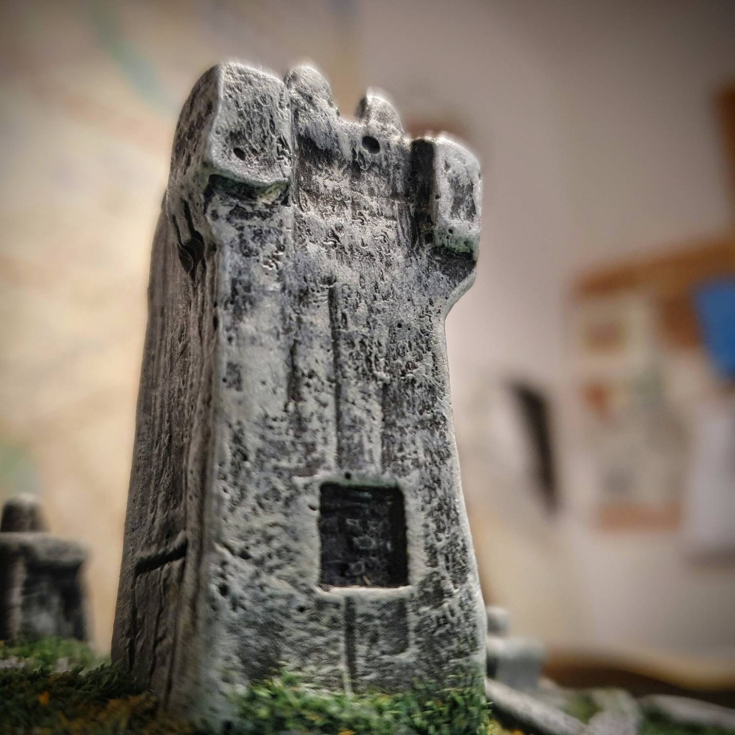
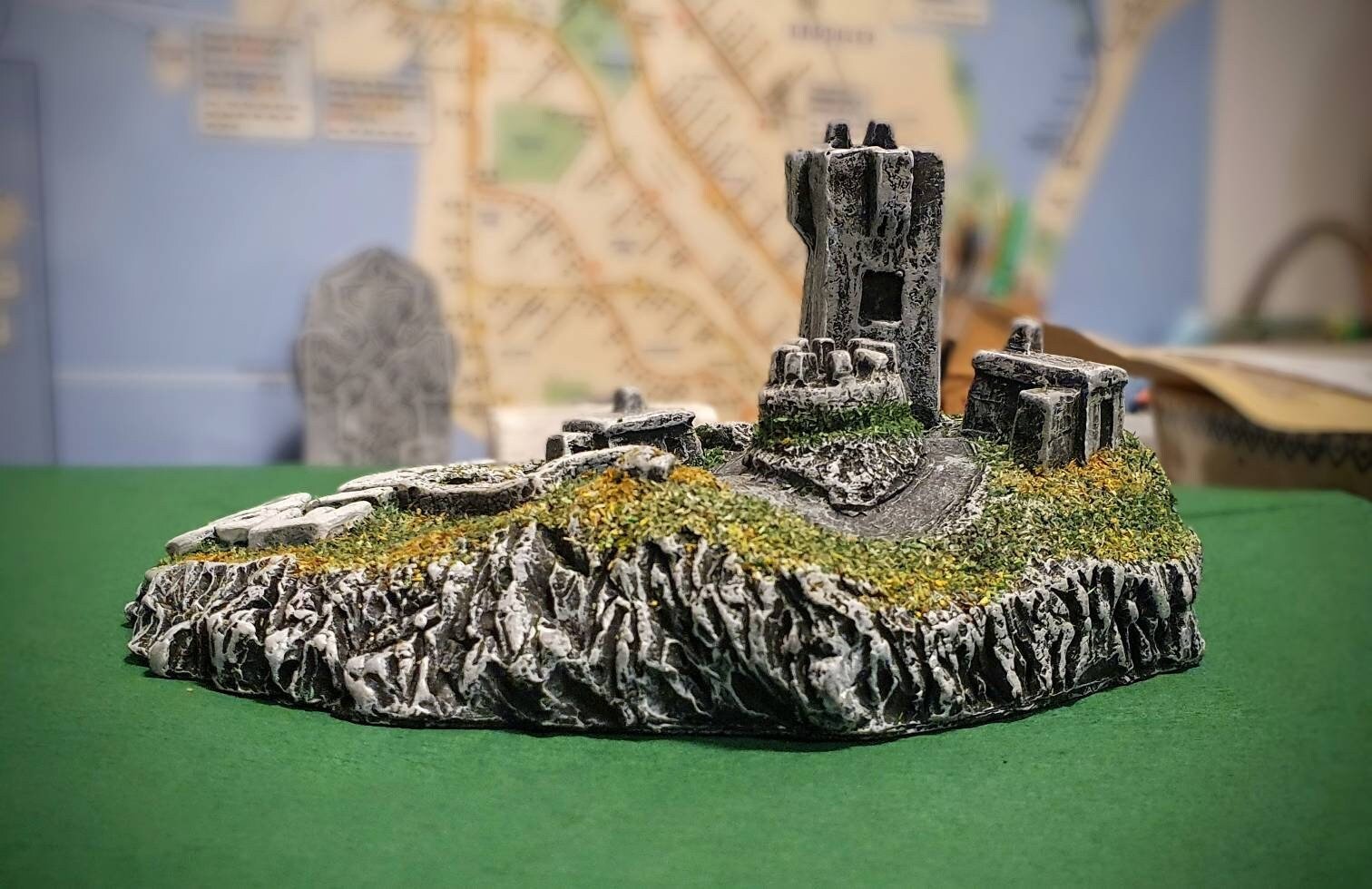
Banba's Crown, Malin Head, Co. Donegal
£53.00
Imagine holding Ireland's most northerly point in the palm of your hand!
Completely handcrafted from locally sourced materials on the Derry/Donegal border.
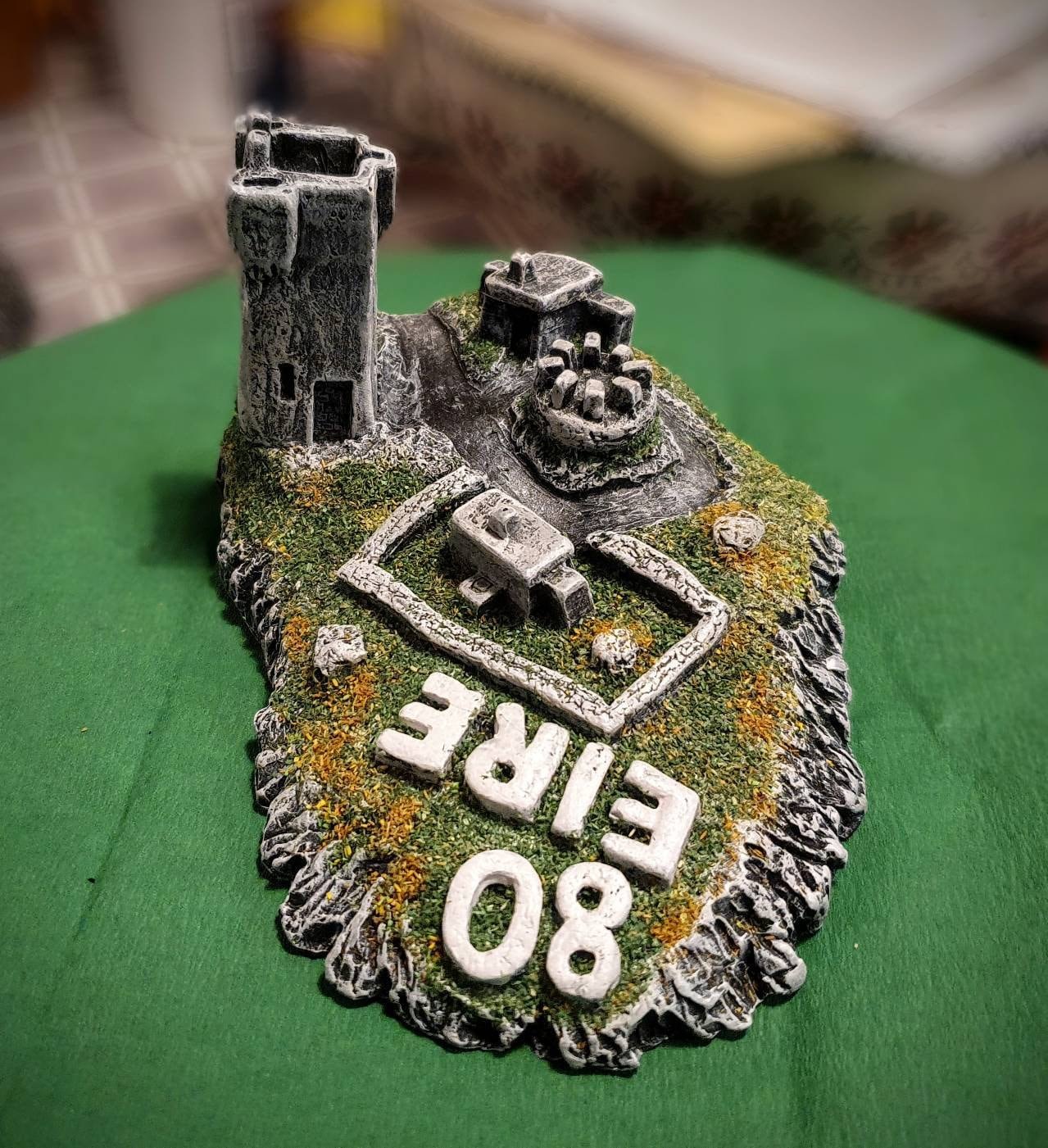
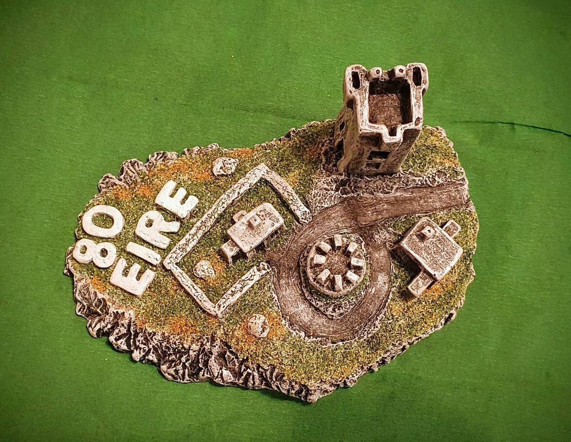
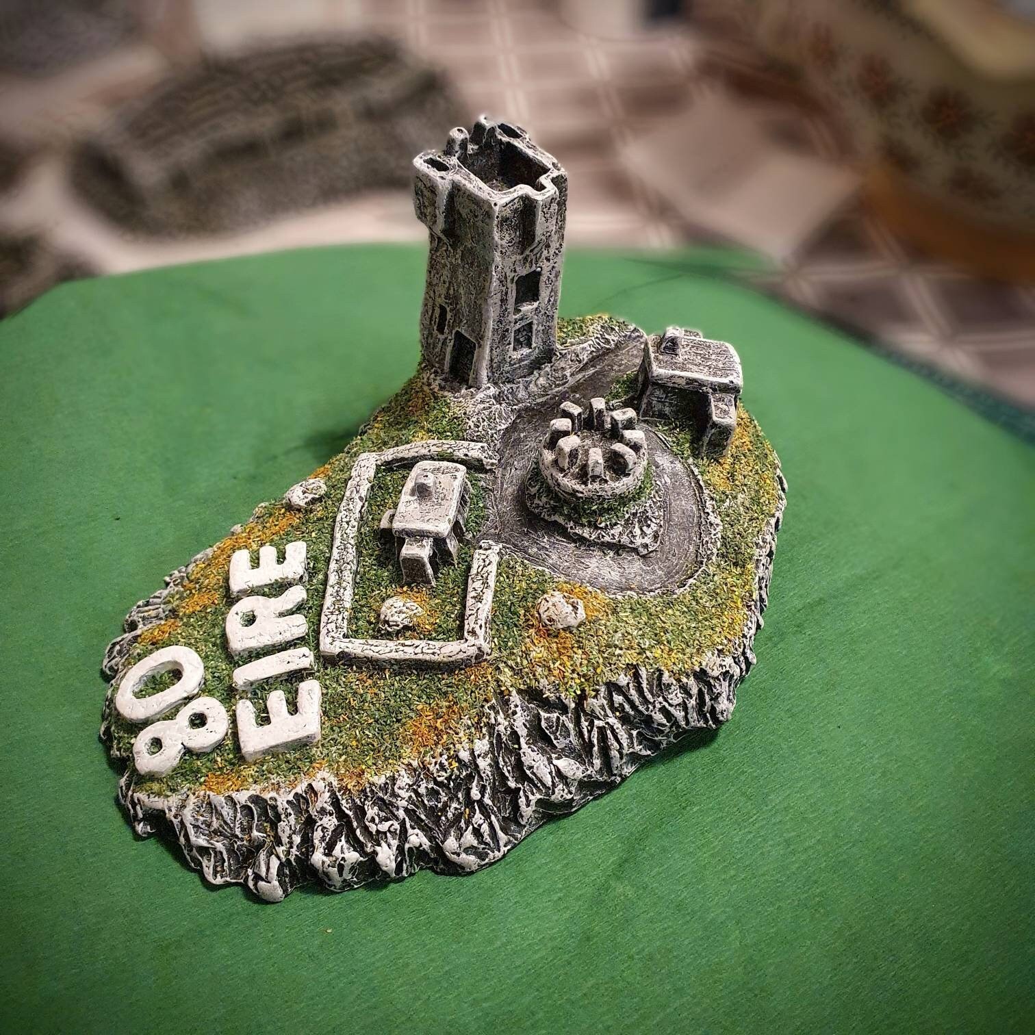
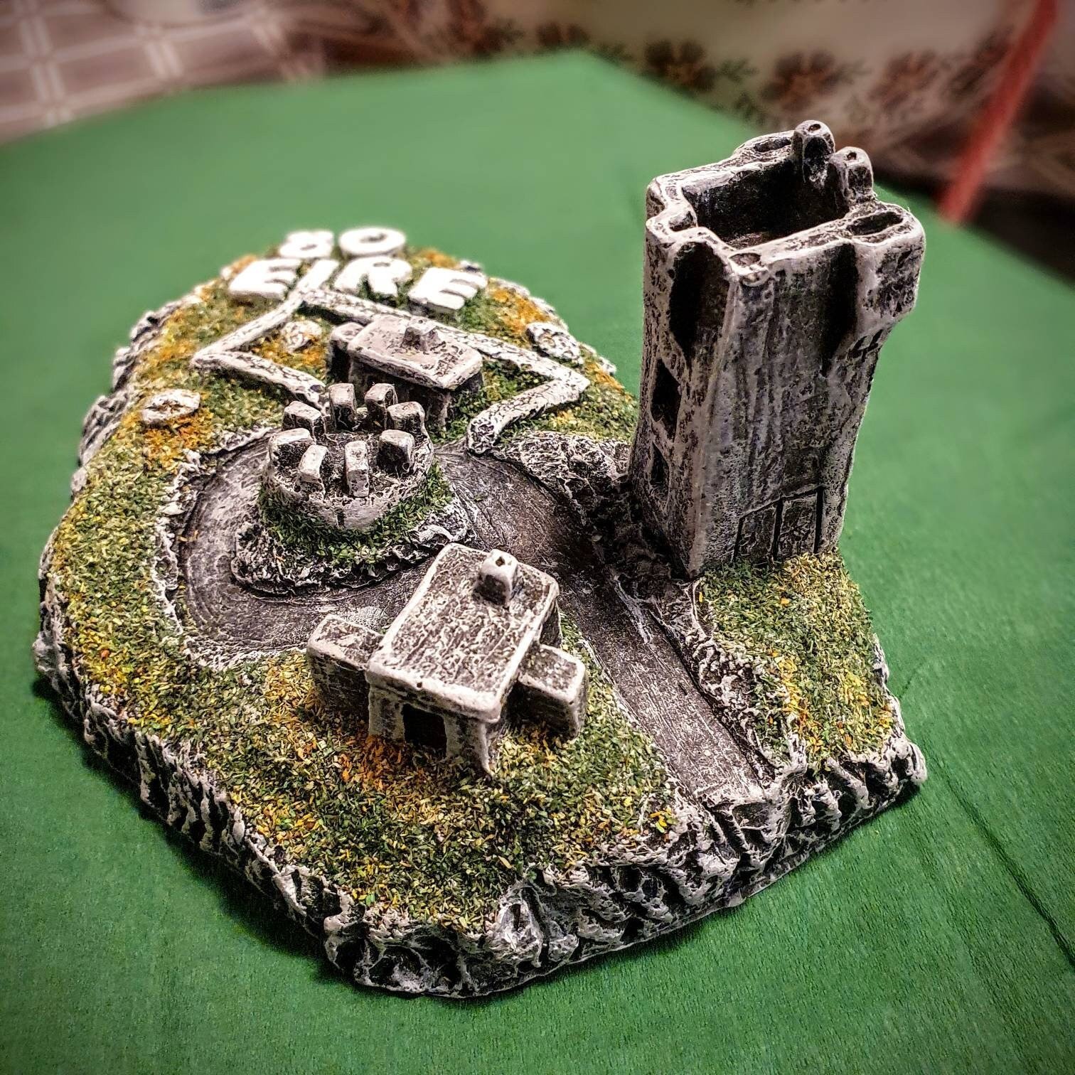
On the northernmost tip of Malin Head, called Banba's Crown, stands a cumbersome 1805 clifftop tower that was built by the British admiralty and later used as a Lloyds signal station. Around it are concrete huts that were used by the Irish army in WWII as lookout posts. To the west from the fort-side car park, a path leads 700m to Hell's Hole, a chasm where the incoming waters crash against the rock forms.
This northernmost point of the Inishowen peninsula and the island of Ireland is named after Banba, the goddess of the Tuatha Dé Danann, the mythological tribe who lived in Ireland in ancient times. Banba and her sisters Ériu and Fódla became the patron goddesses representing the sovereignty and the spirit of Ireland.
With some of the most hazardous waters along Ireland’s coast, Malin Head has a rich history of naval communication. In 1804 the first naval signal station was put in place consisting of a signal mast and a small dwelling hut. Another remainder of war times is the large inscription on the bare rock underneath the tower at Malin Head: the letters laid out in stones and white paint spell out ‘ÈIRE’. They served as a navigational marker during WWII to alert pilots that they were entering Irish airspace. The Irish State was neutral during the war, but Northern Ireland as part of the UK, was not. Despite its neutrality, the Irish State was hit in several German air raids. These ‘Éire neutrality markers’ were laid out at all strategic LOP’s to make pilots aware that they were in fact flying over Ireland. To make navigation easier for allied pilots the relevant number of the LOP was added to some of the signs.
Quantity:
Imagine holding Ireland's most northerly point in the palm of your hand!
Completely handcrafted from locally sourced materials on the Derry/Donegal border.
On the northernmost tip of Malin Head, called Banba's Crown, stands a cumbersome 1805 clifftop tower that was built by the British admiralty and later used as a Lloyds signal station. Around it are concrete huts that were used by the Irish army in WWII as lookout posts. To the west from the fort-side car park, a path leads 700m to Hell's Hole, a chasm where the incoming waters crash against the rock forms.
This northernmost point of the Inishowen peninsula and the island of Ireland is named after Banba, the goddess of the Tuatha Dé Danann, the mythological tribe who lived in Ireland in ancient times. Banba and her sisters Ériu and Fódla became the patron goddesses representing the sovereignty and the spirit of Ireland.
With some of the most hazardous waters along Ireland’s coast, Malin Head has a rich history of naval communication. In 1804 the first naval signal station was put in place consisting of a signal mast and a small dwelling hut. Another remainder of war times is the large inscription on the bare rock underneath the tower at Malin Head: the letters laid out in stones and white paint spell out ‘ÈIRE’. They served as a navigational marker during WWII to alert pilots that they were entering Irish airspace. The Irish State was neutral during the war, but Northern Ireland as part of the UK, was not. Despite its neutrality, the Irish State was hit in several German air raids. These ‘Éire neutrality markers’ were laid out at all strategic LOP’s to make pilots aware that they were in fact flying over Ireland. To make navigation easier for allied pilots the relevant number of the LOP was added to some of the signs.
Completely handcrafted from locally sourced materials on the Derry/Donegal border.
On the northernmost tip of Malin Head, called Banba's Crown, stands a cumbersome 1805 clifftop tower that was built by the British admiralty and later used as a Lloyds signal station. Around it are concrete huts that were used by the Irish army in WWII as lookout posts. To the west from the fort-side car park, a path leads 700m to Hell's Hole, a chasm where the incoming waters crash against the rock forms.
This northernmost point of the Inishowen peninsula and the island of Ireland is named after Banba, the goddess of the Tuatha Dé Danann, the mythological tribe who lived in Ireland in ancient times. Banba and her sisters Ériu and Fódla became the patron goddesses representing the sovereignty and the spirit of Ireland.
With some of the most hazardous waters along Ireland’s coast, Malin Head has a rich history of naval communication. In 1804 the first naval signal station was put in place consisting of a signal mast and a small dwelling hut. Another remainder of war times is the large inscription on the bare rock underneath the tower at Malin Head: the letters laid out in stones and white paint spell out ‘ÈIRE’. They served as a navigational marker during WWII to alert pilots that they were entering Irish airspace. The Irish State was neutral during the war, but Northern Ireland as part of the UK, was not. Despite its neutrality, the Irish State was hit in several German air raids. These ‘Éire neutrality markers’ were laid out at all strategic LOP’s to make pilots aware that they were in fact flying over Ireland. To make navigation easier for allied pilots the relevant number of the LOP was added to some of the signs.
Dimensions: 6” across, 2” high
FREE SHIPPING WORLDWIDE
